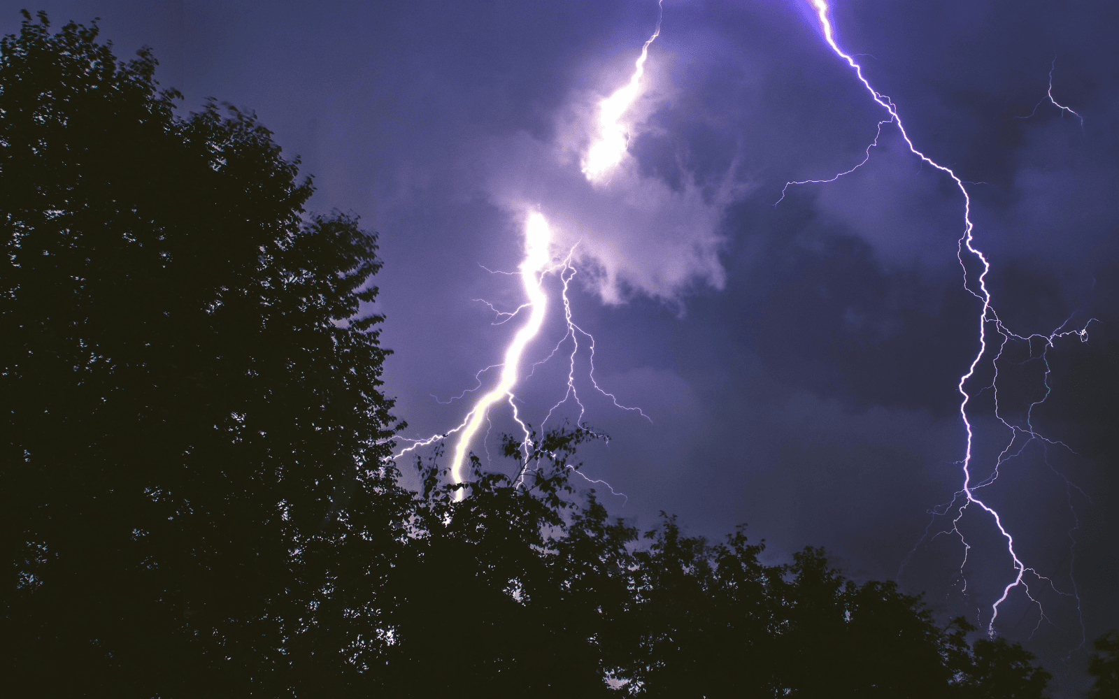
AI model predicts lightning wildfires with 90% accuracy
Israeli researchers use seven years of weather and satellite data to predict future wildfires caused by lightning strikes.
Israeli researchers use seven years of weather and satellite data to predict future wildfires caused by lightning strikes.

Turns out goats and sheep make for pretty decent wildfire control.

The Israel-based international humanitarian organization helps disaster-stricken communities access electricity, Internet, and telecommunication.

As regions from California to the Mediterranean face wildfire threats, these innovations can help win the battle against out-of-control flames.

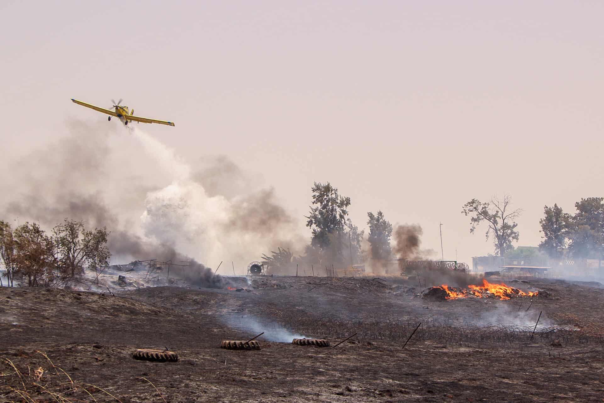
Israeli AI startup, FireDome, inspired by Iron Dome anti-missile system, can detect and suppress wildfires.

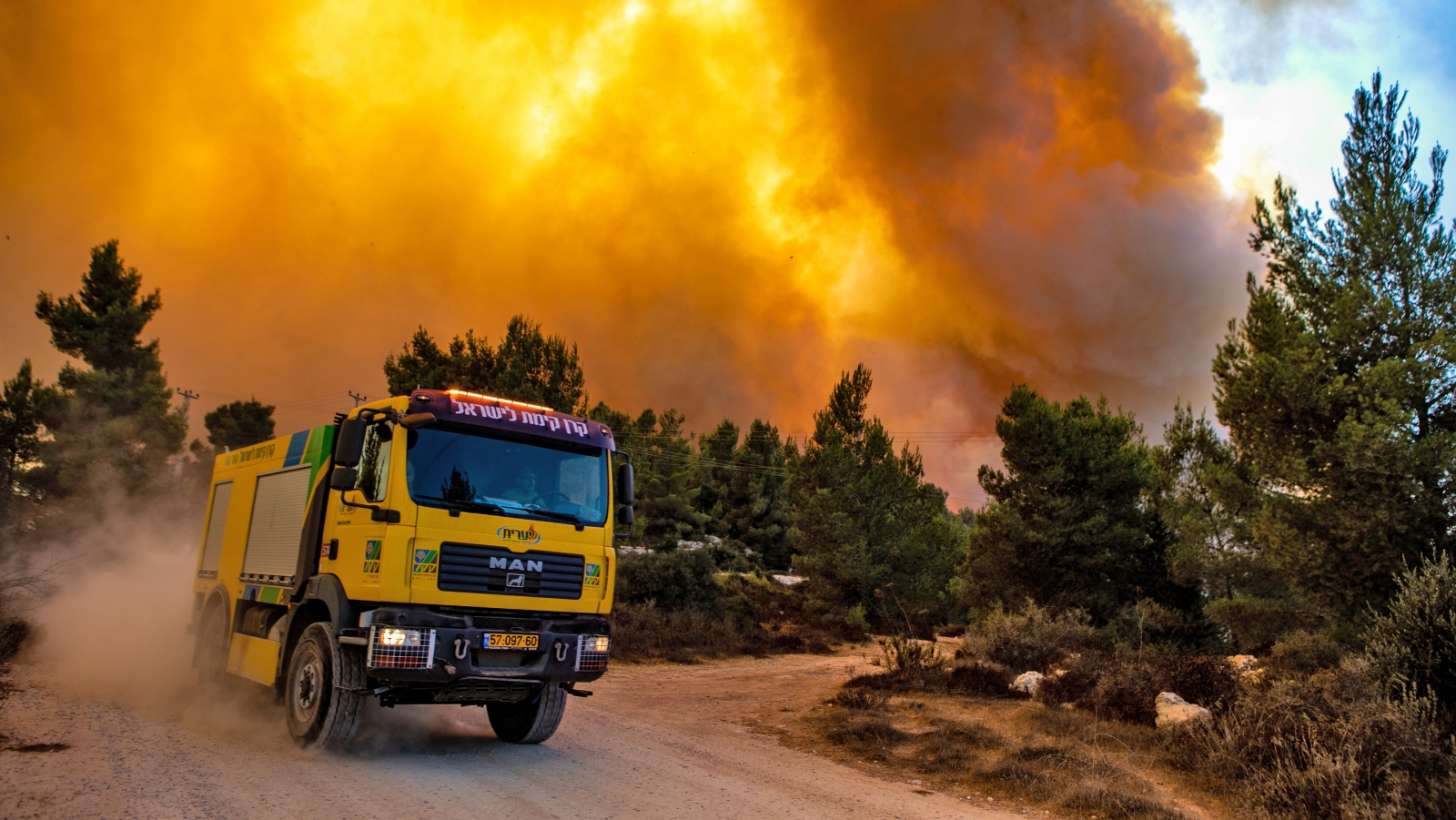
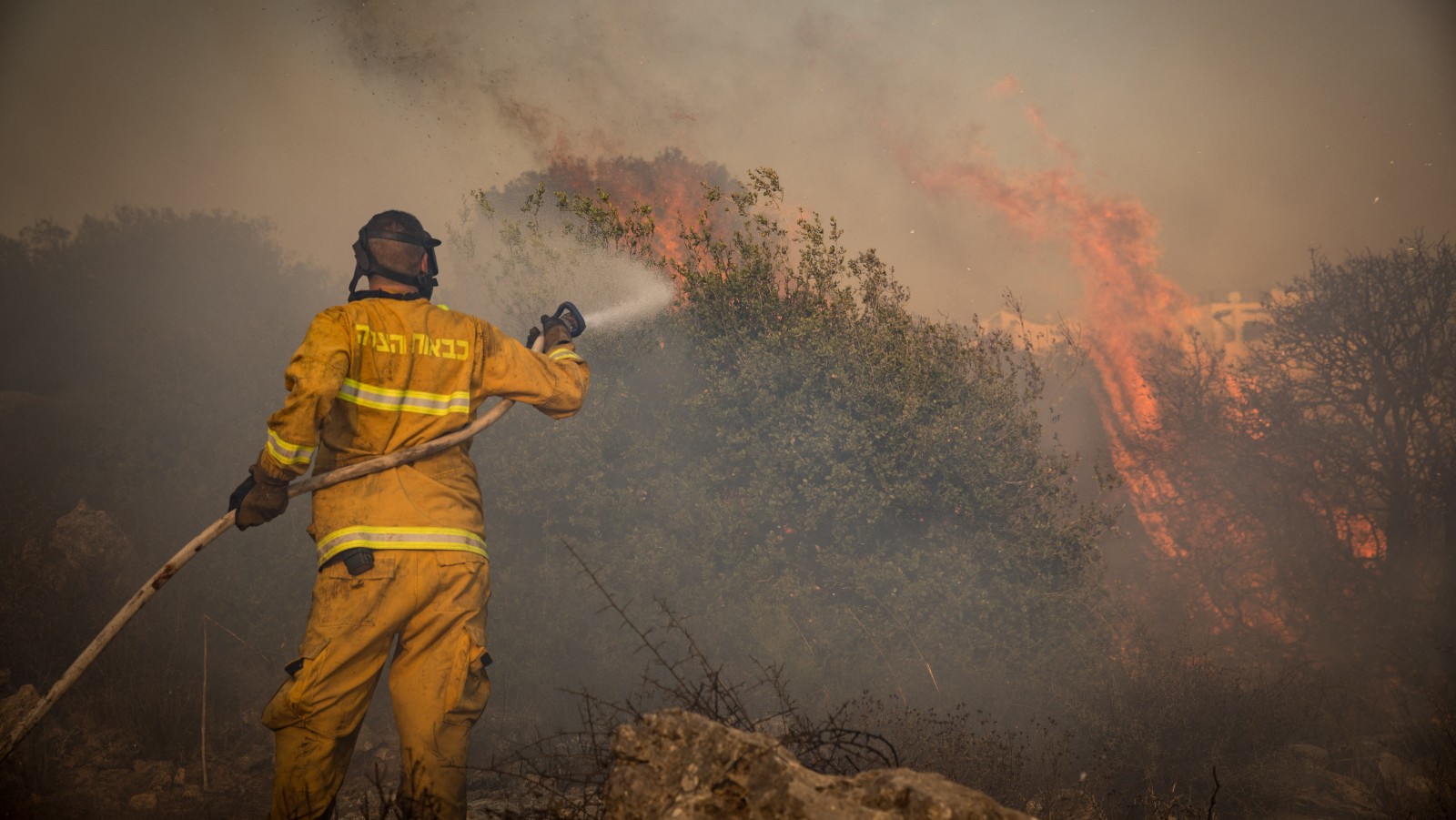
Chasing down forest fires under threat of rocket fire, Israel’s foresters are working constantly against a series of surging flames.
Israeli government confirms at least two ‘Elad’ firefighting planes will be dispatched to the country, which has been struck by an extreme heatwave.
As the planet heats up and wildfire blazes rise from California to South Korea, incidents are steadily decreasing in semi-arid Israel.
January kicks off another year of mega rounds for Israeli companies in fields including cyber, alternative protein, HR tech, biopharma.
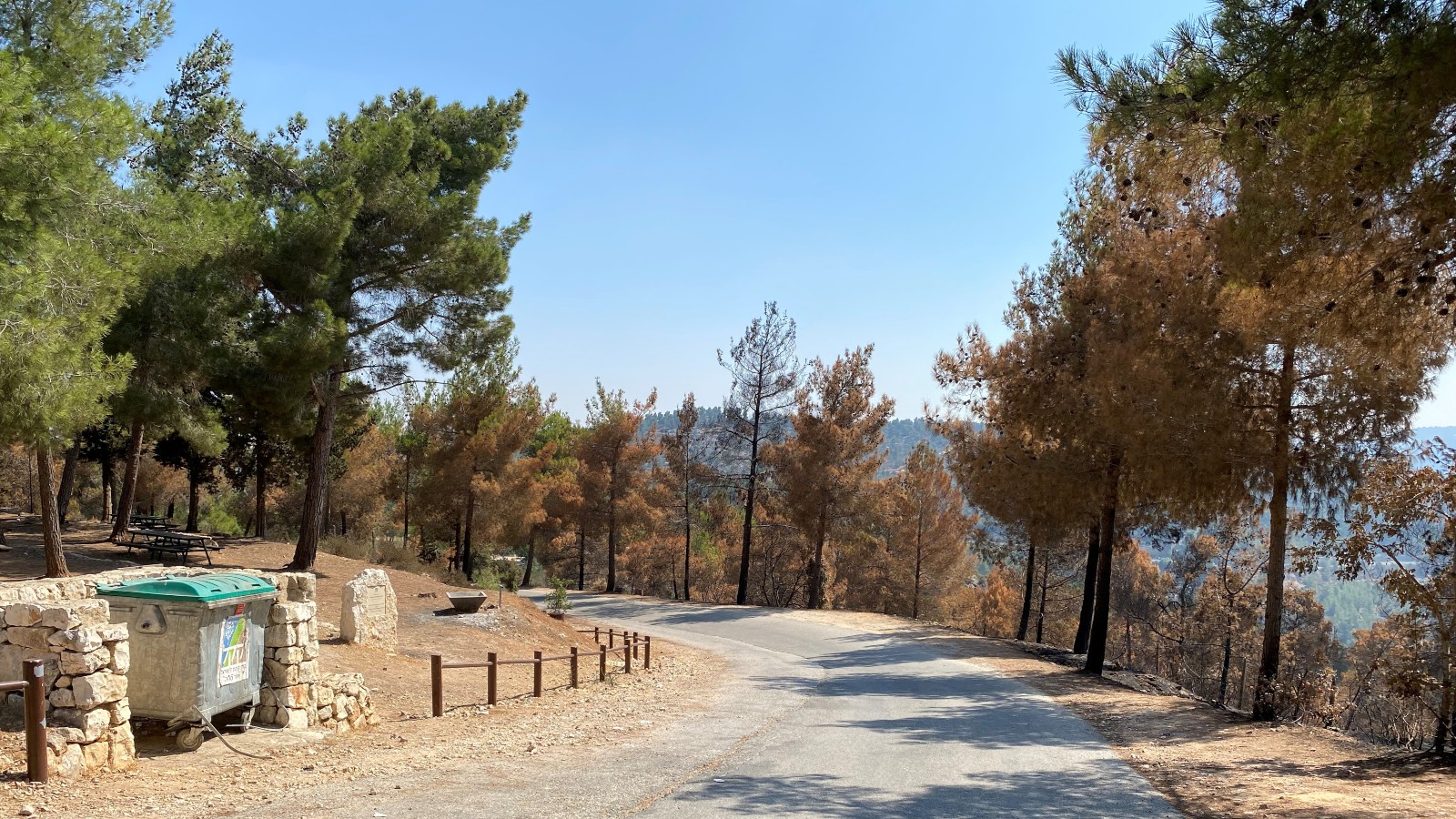
Forester Nurit Hibsher says she’s never seen a fire like the one that blazed through the Jerusalem hills for three days in August. It’s got her worried.

‘Mutual care and saving human lives are common interests to us all,’ Israeli Defense Minister Benny Gantz tweets in Arabic, Hebrew and English.

Their task is all the more difficult and dangerous because of Greece’s most intense heat wave in three decades.

Another strong month for investment in Israeli companies, as 7 firms raise at least $100 million each for a cumulative $1.2 billion.
As wildfires burn more fiercely across the globe, Israeli experts work with other countries to implement prevention, detection, firefighting and rehab strategies.

Edgybees’ augmented reality overlays real-time data over videos taken by drones over the disaster scenes, aiding faster and more accurate planning.